📷 AERIAL PHOTOGRAPHY · LA ROCHE-SUR-YON (85) · €300–900 PER HALF-DAY
Drone aerial photography in La Roche-sur-Yon
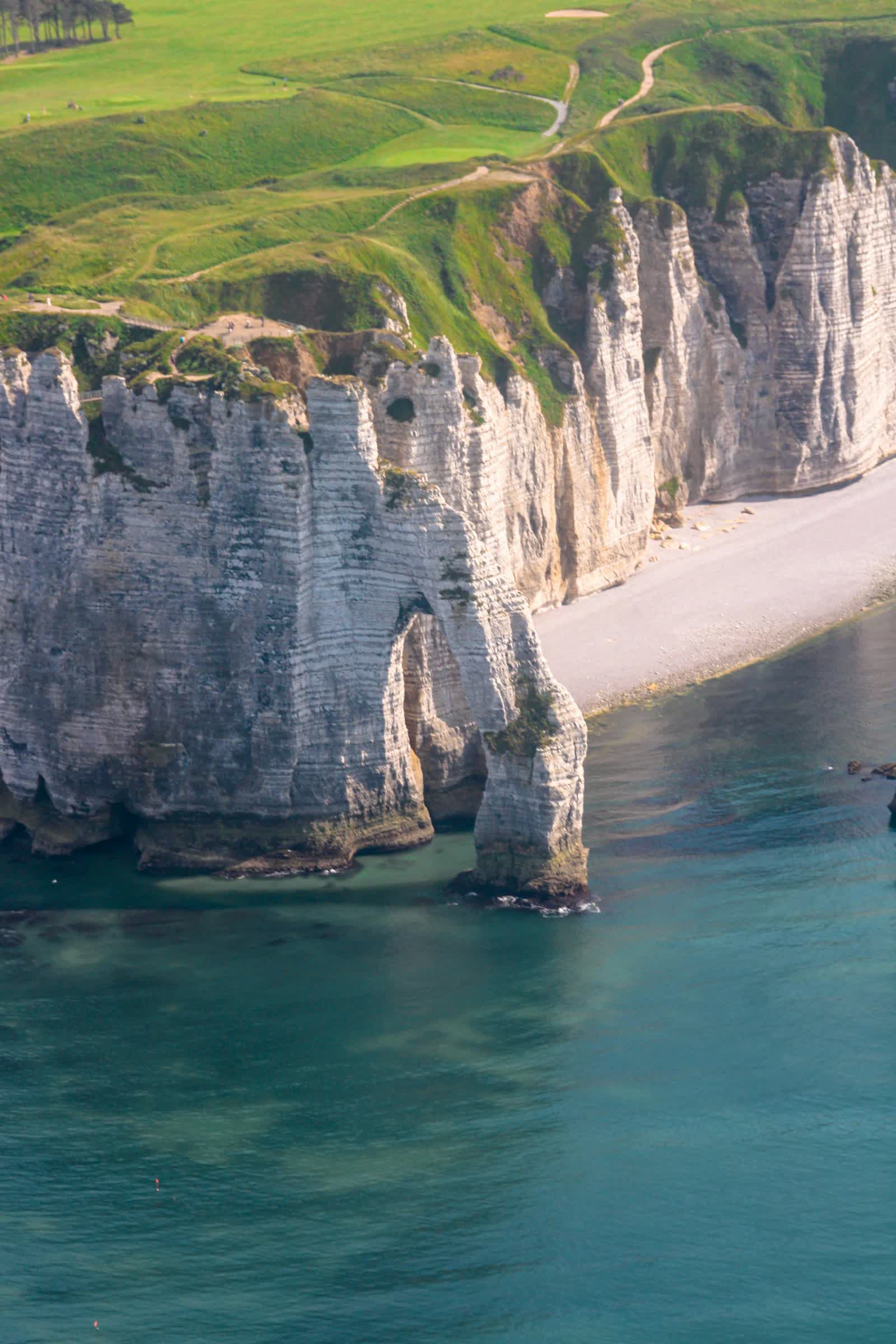
Drone aerial photography delivers viewpoints that are simply unreachable from the ground: 45° plunging shots, panoramas from 120 m up, low grazing perspectives at sunrise. Our remote pilots fly 20 to 50 megapixel sensors on three-axis gimbals, producing RAW files suitable for large-format printing as well as web use. Every mission is prepared on the official French Géoportail drone map to identify local restrictions and, where required, obtain prefectural authorisations for flights in built-up areas.
The service includes location scouting, flight notification where applicable, the shoot itself and post-production (cropping, colour grading, high-definition delivery via download link). Allow half a day to cover one site: a building, an estate, a business park, a coastline or a plot of land. Images are delivered with usage rights tailored to your needs (communications, press, outdoor advertising).
Free quote — aerial photography in La Roche-sur-Yon
Rates
€300–900 per half-day — the range observed on the 2026 French market, including regulatory preparation, flight and delivery. The exact quote depends on the site, the deliverable and the airspace context in La Roche-sur-Yon.
Common use cases
- Aerial view of a head office or industrial site for brochures and websites
- Panorama of a wine estate, golf course or campsite for tourism brochures
- Photo coverage of an outdoor event (festival, sports competition)
- Landscape and coastline photography for tourist offices
- Press illustration and local stock imagery
- Before/after aerial photos of development works
The local context in La Roche-sur-Yon
Prefecture of the Vendée, La Roche-sur-Yon is an urban-planning rarity: a town created from scratch by Napoleon in 1804, with a pentagonal grid plan perfectly legible in aerial photography. Napoléon square, redesigned with its mechanical animals, Saint-Louis church and the Vendée stud farm are its pivots. La Roche-sur-Yon - Les Ajoncs aerodrome (LFRI), to the north-east, is the main local aeronautical constraint.
The department has one of France's lowest unemployment rates, driven by a dense fabric of industrial SMEs (food processing, boat building, construction). For drone pilots this means recurring missions: factory and logistics site imagery, construction monitoring, business real estate, plus event communication (the Vendée Globe starts at Les Sables-d'Olonne, 30 km away) and the heritage of the Vendée bocage.
Applicable regulations
In France, commercial aerial photography is usually flown in the open category: sub-category A1 with a sub-250 g drone (class C0) even near uninvolved individuals, A2 with a class C2 drone (under 4 kg) keeping 30 m from people (5 m in low-speed mode), or A3 far from anyone and more than 150 m from residential areas. Maximum height: 120 m. The pilot must be registered as an operator on AlphaTango, hold the online A1/A3 training certificate (plus the theory exam for A2), and check restricted zones on the Géoportail drone map. Flying over assemblies of people is prohibited; in built-up areas, since 1 January 2026, professional open-category flight over public space is allowed (no overflight of people, daytime only), otherwise a specific-category flight (STS-01 scenario) with prior declaration is required.
Frequently asked questions
Can drone photos be taken in a city?
Yes, under conditions: in built-up areas a commercial flight generally requires a specific-category scenario with prior declaration to the préfecture (10 working days since 1 January 2026). We handle all the paperwork for you.
In what format are the photos delivered?
Images are delivered as high-definition JPEGs (RAW on request) via a secure download link, within 48 to 72 hours of the shoot, colour grading included.
What happens in bad weather?
The flight is rescheduled free of charge to the next suitable window: rain, wind above 40 km/h or fog make flying impossible or the images unusable. We monitor the forecast with you until the day before.
Can this service be flown anywhere in La Roche-sur-Yon?
Almost: Aérodrome de La Roche-sur-Yon - Les Ajoncs (LFRI). Depending on the exact location, the pilot picks the right framework (open or specific category) and files the required declarations — included in the quote.
Other drone services in La Roche-sur-Yon
- Aerial video in La Roche-sur-Yon from €500
- Real estate drone services in La Roche-sur-Yon from €250
- Weddings & events in La Roche-sur-Yon from €400
- Roof inspection in La Roche-sur-Yon from €200
- Facade inspection in La Roche-sur-Yon from €300
- Aerial thermal imaging in La Roche-sur-Yon from €500
- Construction site monitoring in La Roche-sur-Yon from €250
- Surveying & photogrammetry in La Roche-sur-Yon from €800
- Precision agriculture in La Roche-sur-Yon from €8
- Security & surveillance in La Roche-sur-Yon from €600
- Immersive FPV video in La Roche-sur-Yon from €700
- High-access cleaning in La Roche-sur-Yon from €500
- Drone pilot training in La Roche-sur-Yon from €350
- All services in La Roche-sur-Yon
Aerial photography near La Roche-sur-Yon
- Aerial photography in Nantes Pays de la Loire
- Aerial photography in Angers Pays de la Loire
- Aerial photography in Le Mans Pays de la Loire
- Aerial photography in Saint-Nazaire Pays de la Loire
- Aerial photography in Cholet Pays de la Loire
- Aerial photography in Laval Pays de la Loire
Aerial photography: every city →