C-DRONE GUIDE · 18 JUNE 2026
Aerial photo of my house: how to get one (IGN, Google, drone)
You want a view of your house from the sky — for pleasure, as a gift, to sell, or for a renovation file? Good news: several options are entirely free, and the custom drone version costs less than you might think. Here is every way to get an aerial photo of your house in 2026, from a Google screenshot to a professional drone flight.
Free and instant: Google Earth and Google Maps
The fastest option takes two minutes: open Google Maps or Google Earth, type your address, switch to satellite view and take a screenshot. In most French municipalities, the resolution lets you make out the roof, the pool, the driveways and the vegetation. In large urban areas, Google Earth also offers a photorealistic 3D view you can tilt and rotate: by playing with the angle, you get a genuine "from the plane" perspective of your neighbourhood, exportable as an image.
Two limits to know. Freshness first: Google's satellite and aerial imagery is six months to several years old depending on the area — your recent extension or new roof may not be there. Usage rights second: a Google screenshot is tolerated for strictly personal use, but the terms of service tightly restrict commercial use — printing it on your house's sale listing or on a company brochure puts you outside the lines. For a wallpaper or a keepsake, on the other hand, it is perfect and costs nothing.
The IGN: the official aerial photo — including historical ones
The French national mapping agency (IGN) photographs the entire country from aircraft at a resolution of 20 cm per pixel (the BD ORTHO layer), free to browse on the Géoportail website. The imagery is often more recent and more consistent than Google's, and its public-data status makes it far more flexible to use. The icing on the cake: the IGN's "Remonter le temps" (Go back in time) website gives access to aerial photography campaigns going back to the 1920s-1950s. You can see your plot before the house was built, compare two eras side by side, and download the old photographs — an original gift for grandparents, or useful evidence in a property dispute.
For a fine print, the IGN and partner services offer aerial photos centred on your address in poster formats, typically priced at €20 to €60 depending on size. It is the best "frame above the sofa" option without flying anything. The limit remains the same as for any vertical view: shot straight down from 2,000 to 5,000 m, it shows your roof, not your façade, and you cannot choose the date.
The limits of satellite and aircraft imagery
Why not stop at the free options? Because they share three structural flaws. Resolution first: at 20 cm per pixel, a house with a 10 m frontage spans 50 pixels — enough to recognise it, not enough for a beautiful large-format print or to assess the state of the tiles. Angle second: the vertical view flattens volumes; what makes an aerial photo of a house spectacular is precisely the low-altitude oblique view, the one showing the façade, the garden and the landscape behind all at once. Apart from Google's urban 3D views, no free option offers it for a house in a rural or suburban area.
Date last: you choose neither the season, nor the hour, nor the light. The satellite photo of your house may have been taken on a grey November day, cover on the pool and the neighbour's car in the drive. For an emotional or commercial use — selling the property, a holiday rental, a B&B — that is a deal-breaker: you want the garden in bloom, golden late-afternoon light and a composition that flatters. That is exactly what a drone delivers.
The drone photo: made to measure, from €80
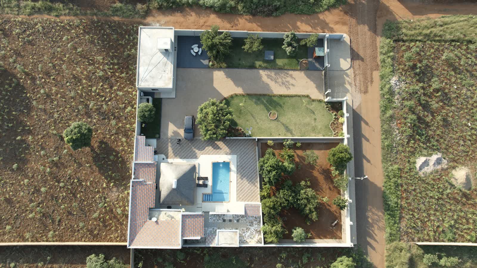
A professional pilot comes to your home, chooses the time and angles with you, and delivers high-definition images impossible to obtain any other way: an oblique view from 30 m showing the house in its setting, a top-down view of the plot, roof details. Budget-wise, a simple photo session — a few views of a house, retouched and delivered in high definition — bills at around €80 to €150; a full photo-and-video package for a property sale runs from €150 to €500 depending on the property and deliverables. The price includes what makes the operation legal: a registered pilot, aerial liability insurance and compliance with overflight rules.
Three uses dominate. Property sales first: listings with aerial views stand out immediately — our guide to selling a property with aerial views quantifies the impact. Keepsakes second: a birthday gift, leaving a family home, a large-format print. Technical files last: roof condition before works, a boundary dispute, a planning application. To get a quote near you, see our aerial photography by drone page.
Doing it yourself with a drone: what is allowed
If you own a recreational drone, photographing your own house is possible — under conditions. Outside built-up areas, you may take off from your garden and fly over your plot up to 120 m, provided you are not in a restricted zone (check the restrictions map on Géoportail: nearby aerodromes, helipads, sensitive sites). In built-up areas the rule is stricter: open-category flight over public space is prohibited for private individuals — you may fly above your own land, at moderate height, without drifting over the street or the neighbours. Privacy law applies in every case: framing the neighbour's plot or their terrace can engage your liability.
Do not forget the general obligations: drone registration on AlphaTango and the online training from 250 g (or below that weight if the drone carries a camera and is not a toy), flight within visual line of sight, never over people. For a simple keepsake photo of your house in an open area, a well-flown sub-250 g drone does the job. As soon as the context gets harder — town centre, dense neighbourhood, controlled airspace — or the image is meant to sell, an insured, declared professional remains the no-surprises choice.
Summary and frequently asked questions
The options compared at a glance:
| Option | Price | Strengths | Limits |
|---|---|---|---|
| Google Earth / Maps | Free | Instant, 3D view in cities | Dated imagery, no commercial use |
| Géoportail / IGN | Free | Public data, consistent quality | Vertical view only |
| IGN "Remonter le temps" | Free | Historical photos back to ~1930 | Black and white, variable resolution |
| Framed IGN print | €20 – €60 | Fine official print | Date and light not chosen |
| Professional drone photo | €80 – €500 | Made to measure, HD, oblique views | The only paid option |
How can I see my house from the sky for free? Google Maps in satellite view or the French Géoportail, simply by typing your address.
How do I find an old aerial photo of my house? On the IGN's "Remonter le temps" website, which overlays photographic campaigns going back to the interwar years.
How much does a drone photo cost? Around €80 to €150 for a simple photo session, €150 to €500 for a full real-estate photo-and-video package.
Can a drone photograph my house without my consent? Photographing you or your private life, no: privacy law applies. Merely flying legally over the neighbourhood, however, is not in itself prohibited.