🌡️ AERIAL THERMAL IMAGING · STRASBOURG (67) · €500–1,800 PER JOB
Drone aerial thermal imaging in Strasbourg
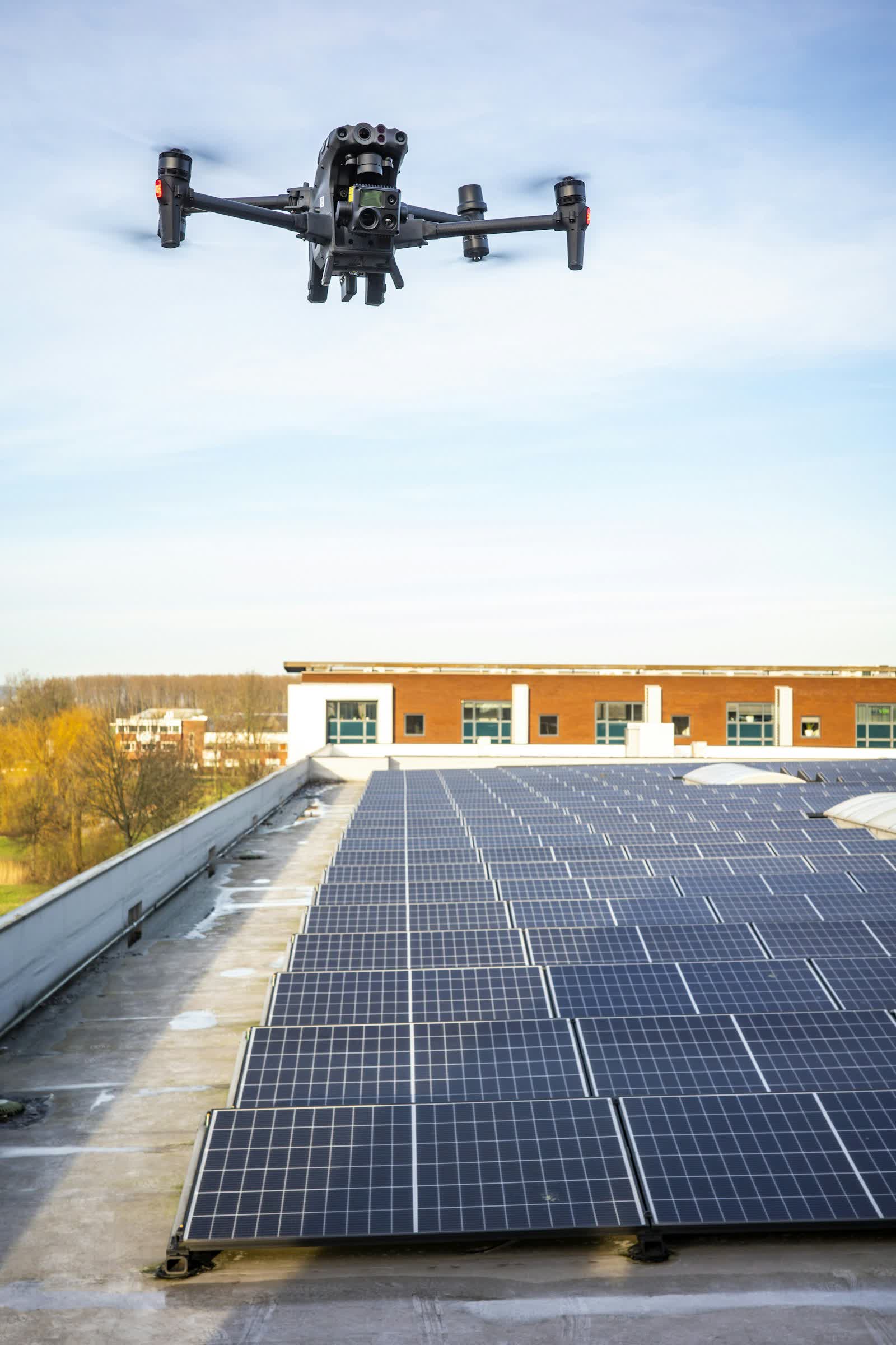
Drone thermography pairs a calibrated radiometric infrared camera with aerial mobility: in a single flight it reveals heat loss from a roof, insulation defects in a building envelope, failing photovoltaic panels (hot spots, blown diodes, dead strings), leaks in buried heat networks and water ingress beneath waterproofing membranes. Every pixel carries a usable temperature measurement, not just a colour.
Our thermal flights respect proper measurement conditions (indoor/outdoor temperature differential, absence of direct sun where required, humidity) and are paired with visible imagery to locate each anomaly. The report, produced in radiometric software by an operator trained in building thermography, locates and quantifies every defect. It is the reference tool for energy audits, photovoltaic plant operation and large-scale leak detection.
Free quote — aerial thermal imaging in Strasbourg
Rates
€500–1,800 per job — the range observed on the 2026 French market, including regulatory preparation, flight and delivery. The exact quote depends on the site, the deliverable and the airspace context in Strasbourg.
Common use cases
- Thermal inspection of a ground-mounted or rooftop photovoltaic plant
- Heat-loss audit of a commercial building or co-owned residence
- Leak detection on a buried district-heating network
- Detecting water ingress beneath flat-roof waterproofing
- Searching for people or animals (verification flights, fawns before mowing)
- Insulation checks before/after energy renovation works
The local context in Strasbourg
Strasbourg has one peculiarity: a prohibited area protects the European institutions district (Parliament, Council of Europe, Human Rights Court), on top of the Strasbourg-Entzheim CTR to the south-west. The immediate German border means flights must not spill into neighbouring airspace, and the UNESCO-listed Grande Île falls under the built-up-area scenario with prefecture notification.
The local economy offers fine missions: inspection of the river port and structures on the Rhine, thermography of demanding half-timbered old buildings, monitoring of the Archipel business district extensions, imagery for the Christmas market — France's oldest — and for the Alsatian wine route starting just outside town.
Applicable regulations
Thermography follows the rules of the site being flown: open category A2/A3 for ground-mounted solar farms and buildings in clear areas (professional thermal drones usually exceed 900 g), specific category STS-01 with prefectural declaration for buildings in built-up areas. One specificity: building thermal flights are ideally flown at dawn or at night in winter, yet night flying is prohibited in the open category — it requires a specific-category authorisation or falls back on permitted dawn/dusk slots. Height under 120 m, AlphaTango operator registration, and particular care with parasitic reflections, which dictate controlled shooting angles.
Frequently asked questions
What time of year should building thermography be done?
From October to April, when the gap between the heated interior and the outside reaches at least 10°C. Flights take place early in the morning, before the sun warms the walls and skews the readings.
How much solar capacity can be inspected in one day?
An automated flight covers 10 to 20 MWp per day depending on the plant layout, with automatic hot-spot detection and each faulty module located by its coordinates.
Does the thermal camera measure exact temperatures?
Yes, provided a calibrated radiometric camera is used and material emissivity and ambient conditions are entered: typical accuracy is then ±2°C, sufficient for any building or photovoltaic survey.
Can this service be flown anywhere in Strasbourg?
Almost: Zone interdite du quartier des institutions européennes; CTR de Strasbourg-Entzheim; Frontière allemande immédiate (espace aérien étranger). Depending on the exact location, the pilot picks the right framework (open or specific category) and files the required declarations — included in the quote.
Other drone services in Strasbourg
- Aerial photography in Strasbourg from €300
- Aerial video in Strasbourg from €500
- Real estate drone services in Strasbourg from €250
- Weddings & events in Strasbourg from €400
- Roof inspection in Strasbourg from €200
- Facade inspection in Strasbourg from €300
- Construction site monitoring in Strasbourg from €250
- Surveying & photogrammetry in Strasbourg from €800
- Precision agriculture in Strasbourg from €8
- Security & surveillance in Strasbourg from €600
- Immersive FPV video in Strasbourg from €700
- High-access cleaning in Strasbourg from €500
- Drone pilot training in Strasbourg from €350
- All services in Strasbourg
Aerial thermal imaging near Strasbourg
- Aerial thermal imaging in Reims Grand Est
- Aerial thermal imaging in Metz Grand Est
- Aerial thermal imaging in Mulhouse Grand Est
- Aerial thermal imaging in Nancy Grand Est
- Aerial thermal imaging in Colmar Grand Est
- Aerial thermal imaging in Troyes Grand Est
Aerial thermal imaging: every city →